Developing Near Stations

As a supplement to my 31 August 2026 blog post Push The Button: The Pro-Development Presumptions, “Substantial Weight” & “Support” Policies In The New NPPF, I thought it might be helpful if I simply set out in a post the relevant policies in the new NPPF that articulate the government’s encouragement to certain forms of development near some stations, trumping any “materially inconsistent” development plan policies, which now have “very limited weight” (Annex A, paragraph 2).

We start with the pro-development presumption within policy S5 that kicks in for specific categories of development. Here, category h is relevant:

S5: Principle of development outside settlements

1. Only certain forms of development should be approved outside settlements, as set out in the following list. These should be approved, unless the benefits of doing so would be substantially outweighed by any adverse effects, when assessed against the national decision-making policies in this Framework:

h. Residential and mixed-use development which would:

i. Be within reasonable walking distance of a well-connected station (applying the definitions in the glossary at Annex B);

ii. Be physically well-related to the station or the settlement within which the station is located;

iii. Be of a scale which can be accommodated taking into account the existing or proposed availability of infrastructure; and

iv. Not prejudice any proposals for long-term comprehensive development in the same location.

You look to the glossary to see what “reasonable walking distance” and “well-connected station” mean:

Reasonable walking distance: For the purpose of policies S5, L3, GB7 (relating to land around well-connected stations), this should be considered to be around 800 metres, or around 10 minutes’ walk time if topography, route availability and quality or physical barriers would prevent or discourage walking from up to 800 metres away. […]  Where a reasonable walking distance is required to be calculated when applying policies S5(1)(h), L3(2)(c) and GB7(1)(h), and only part of the site falls within the reasonable walking distance, those sub-paragraphs of policies S5, L3 and GB7 only apply to the area of the site within that reasonable walking distance.

Well-connected station: Railway stations and underground, tram and light rail stops located within a top 80 Travel to Work Area located partially or fully within England by Gross Value Added (GVA) and which, in the normal weekday timetable, are served (or have a reasonable prospect of being served due to planned upgrades or through agreement with the rail operator) throughout the daytime by at least four trains or trams per hour overall, or at least two trains or trams per hour in any one direction.

Footnote 72 , against “top 80 Travel to Work Area located partially or fully within England by Gross Value Added (GVA)”, states:  “For the purpose of assessing whether Travel to Work Areas fall within this definition, the 2023 GVA data should continue to be used up to the day after the publication of the 2028 GVA data. For subsequent years, the GVA data used for the purpose of this definition should continue to be regarded as fixed for each five year period. Published in: https://www.ons.gov.uk/economy/grossvalueaddedgva/datasets/ukgvaandproductivityestimatesforothergeographies .”

Policy S5 5 makes it clear that the S5 presumption also applies to any development in the green belt which is not “inappropriate”. Category h of policy GB7 replicates category h of S5, but with the additional requirement that the golden rules in policy GB 8 are to be followed.

GB7: Development which is not inappropriate in the Green Belt

1. The following categories of development are not inappropriate in the Green Belt, and therefore should not be regarded as harmful to the Green Belt or be required to demonstrate very special circumstances:

…..

h. Residential or mixed-use development which would:

i. Be within reasonable walking distance of a well-connected station (applying the definitions in the glossary at Annex B);

ii. Be physically well-related to the station or the settlement within which the station is located;

iii. Be of a scale which can be accommodated taking into account the existing or proposed availability of infrastructure;

iv. Not prejudice any proposals for long-term comprehensive development in the same location; and

v. In the case of proposals for major development, comply with policy GB8.

The golden rules in GB8 are, in summary:

  • Affordable housing “which is 15 percentage points above the highest existing affordable housing requirement which would otherwise apply to the development, subject to a cap of a 50%”
  • Necessary improvements to local or national infrastructure
  • The provision of new green space, or improvements to existing green space, which is accessible to the public. New residents should be able to access good quality green spaces within a short walk of their homes, whether through on-site provision or through access to offsite spaces. […]

Finally, when developing within one of these sites (whether in the green belt or not, and whether within a settlement or not) the minimum density requirements in policy L3 kick in:

L3: Achieving appropriate densities

1. Development proposals should make efficient use of land, taking into account the identified need for different types of housing and other development, local market conditions, the availability of infrastructure (including that supporting sustainable transport modes) and its scope for improvement, a site’s connectivity and the importance of securing well-designed, attractive and healthy places.

2. To contribute to making efficient use of land:

…..

c. Where development proposals for residential or mixed-use schemes are within reasonable walking distance of a well-connected station (applying the definitions in the glossary at Annex B), a density of at least 35 dwellings per hectare should be achieved within the net developable area of the site. Higher densities – of at least 45 dwellings per hectare – should be achieved where the service frequency is at least twice that of the minimum required for a well-connected station. Exceptions to meeting these minimum standards should be made only in the case of:

i. Sites which fall below the threshold for major development where it can be demonstrated that meeting the standard is either inappropriate or not possible; or

ii. Development for traveller sites.

3. The minimum densities in paragraph 2(c) of this policy should be exceeded where possible, especially in areas of high connectivity, to optimise the efficient use of land. The Connectivity Tool (Connectivity Tool – GOV.UK) should be used alongside other relevant quantitative or qualitative evidence in assessing the connectivity of particular locations proposed for development.

4. Development proposals that do not make efficient use of land in accordance with paragraph 2 of this policy should be refused.

So we all now have the criteria to be met. Of course, a few uncertainties remain, for instance:

  • Any possible wriggle room in that 800m /10 minutes’  walking distance  
  • The lack of a readily available public source interpreting the government’s GVA datasets meaning that many of us are relying on consultancies’ analysis to arrive at that top 80 list.
  • Some nuances in looking at station timetables for service frequency and as to when there may be a reasonable prospect of service improvement.

Well done Lord Banner for tabling a written question to the government in the House of Lords as to “whether they intend to publish a list of the “well-connected stations” within the meaning of Policy S5(1)(h) and Annex B of the August 2026 National Planning Policy Framework; and, if not, why not.”

Everyone on board?

Simon Ricketts, 5 September 2026

Personal views, et cetera
Push The Button: The Pro-Development Presumptions, “Substantial Weight” & “Support” Policies In The New NPPF

To maximise the prospect of securing planning approval, scheme promoters need to ensure that their schemes press as many of the relevant buttons in the new NPPF as possible.

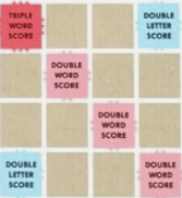
I have counted 21 of them, which I set out below. Most have detailed qualifying criteria to meet, but hopefully this will allow you to see the wood for the trees in applying the new policy framework. Not triggering the particular policy may in some cases count against you in the planning balance, so this is not quite just the Scrabble approach of always looking to maximise use of those triple word scores.

S3: Presumption in favour of sustainable development

1. Decisions on development proposals should apply a presumption in favour of sustainable development. This means:

a. Policy S4 in this Framework should be applied when considering development proposals within settlements;

b. Outside settlements, policy S5 should be applied; and

c. In all locations, development proposals that accord with both an up-to-date development plan and the decision-making policies in this Framework should be approved without delay.

S4: Principle of development within settlements

  1. Development proposals within settlements should be approved unless the benefits of doing so would be substantially outweighed by any adverse effects, when assessed against the national decision-making policies in this Framework.

S5: Principle of development outside settlements

  1. Only certain forms of development should be approved outside settlements, as set out in the following list. These should be approved, unless the benefits of doing so would be substantially outweighed by any adverse effects, when assessed against the national decision-making policies in this Framework.

For developments outside settlements, falling within the a to j list is vital. If your land is green belt the development proposed must not be “inappropriate development” and must therefore fall within one of the a to h criteria in policy GB7 1 – so grey belt development, for instance, also qualifies for this strong pro-development presumption.

CC2: Mitigation of climate change

2. Substantial weight should be given to the benefits of improving the energy efficiency of existing buildings and/or drawing energy from district heat networks, renewable and low carbon sources (including through the installation of heat pumps and solar panels where these do not already benefit from permitted development rights) where this would be achieved through proposals for development.

CC3: Adaptation to climate change

2. Substantial weight should be given to the benefits of improving the resilience of existing buildings and public spaces to anticipated climate change impacts where this would be achieved through proposals for development.

HO7: Meeting the need for homes

1. In applying the policies in this Framework, substantial weight should be given to the benefits of providing homes which will contribute towards meeting the evidenced accommodation needs of the community, as identified through needs assessments prepared for the area of the local planning authority and other relevant evidence. This includes, but is not limited to, homes needed for different groups assessed under policy HO1.

E2: Meeting the need for business land and premises

1. To support business growth, substantial weight should be given to:

a. The economic benefits of proposals for commercial development which allow businesses to invest, expand and/or adapt; especially where this would support the economic vision and strategy for the area, the implementation of the Industrial Strategy, support improvements in freight and logistics and/or reflect proposals for Industrial Strategy Zones and AI Growth Zones; and

b. Benefits for domestic food production, animal welfare and/or the environment which can be demonstrated through proposals for development for farm and agricultural modernisation.

TC2: Development in town centres

1. In considering proposals for development in town centres, substantial weight should be given to the benefits of:

a. Supporting the overall vitality and viability of the centre, including where this can be achieved through the diversification of uses, intensification and provision of residential accommodation (provided this would not conflict with policies in the development plan for specific locations); and

b. Improving or retaining access to local shops and other facilities which provide day-to day services for the local community.

CO1: Proposals for telecommunications infrastructure

1. In considering proposals for the expansion or upgrading of electronic telecommunications networks, substantial weight should be given to the benefits of maintaining or improving network coverage, capacity, reliability and resilience, including where significant improvements are required such as along rail corridors. This includes, but is not limited to, providing for next generation wireless technologies (such as standalone 5G), gigabit capable broadband connections and supporting infrastructure such as fibre exchanges.

W3: Renewable and low carbon energy development and electricity network infrastructure

1. In considering proposals for renewable and low-carbon energy development and electricity network infrastructure, substantial weight should be given to:

a. The benefits for improving energy security, supporting economic development and/or the transition to a net zero future;

b. In the case of applications for the re-powering and life-extension of existing sites, the additional benefit of utilising an established site for this purpose; and

c. The contribution that small-scale and community-led renewable and low carbon energy projects can make to reducing greenhouse gas emissions, along with their associated economic and social benefits.

W4: Water infrastructure

1. In considering proposals for water supply, drainage and wastewater development, substantial weight should be given to the benefits of: a. Providing the capacity needed to serve proposed development and/or improving the security of supply and capacity for existing users (both residential and commercial, including agricultural users); and

b. Improving water quality and reducing water-borne pollution.

M3: Assessing the benefits of mineral development

1. In assessing proposals for minerals development, substantial weight should be given to the benefits of mineral extraction and processing, including to the economy.

L2: Making effective use of land

1. Substantial weight should be given to the benefits where a development proposal would achieve one or more of the following:

a. Remediating despoiled, degraded, derelict, contaminated or unstable land;

b. Making better use of vacant and underutilised land and buildings (such as: by bringing back into residential use empty homes and other suitable buildings; converting space above shops; redeveloping underutilised retail and business sites; and building on or above service yards, lock-ups, car parks and other transport infrastructure which are no longer required);

c. Making effective use of previously developed land and buildings through temporary uses, in situations where alternative development is anticipated within a reasonable period (including as a result of the land being allocated for an alternative purpose in the development plan); or

d. Creating additional homes or floorspace within settlements by using the airspace above existing residential and commercial premises, or through sensitive redevelopment or additional development within existing plots (including, but not limited to, the addition of mansard roofs, proposals to fill gaps in the existing roof line, the introduction of higher buildings at street corners and additional units within residential curtilages).

GB8: The Golden Rules

2. In considering applications for major development involving the provision of housing on land released from the Green Belt through plan preparation or review, or on sites in the Green Belt subject to a planning application, substantial weight should be given to the importance of complying with the Golden Rules.

DP3: Key principles for well-designed places

5. Substantial weight should also be given to outstanding or innovative designs which promote high levels of sustainability, or which help raise the standard of design more generally in an area, so long as they are consistent with the overall form and layout of their surroundings.

HC4: Proposals for new and improved community facilities, public service infrastructure and development providing public health benefits

1. Substantial weight should be given to the benefits where:

a. New or improved public service infrastructure or community facilities would be provided; and

b. Development proposals would make a demonstrable contribution towards promoting good health, preventing ill-health, reducing health inequalities or supporting social interaction in the local community (such as, but not limited to, the provision of new recreation facilities, meeting places and opportunities to grow or purchase healthier food).

P6: Land and operations for defence and public safety

1. Substantial weight should be attached to the importance of sites, activities, facilities and infrastructure required to maintain and enhance defence capability, or whose primary purpose is public safety (including uses such as coastal protection works, coastguard and lifeboat facilities and emergency services telecommunications infrastructure), when considering:

a. Proposals for such development (whether through modernisation, intensification, redevelopment or expansion for operational and related purposes); and

b. Proposals which could affect their operational activity and capability, including situations where other development should only proceed where it can make alternative or replacement provision for defence or public safety operations which would otherwise be affected, or where noise from operational activities could affect the proposed development (in which case policy P4 should also be applied).

HE6: Proposals affecting designated heritage assets

  1. Development proposals which would have a positive effect on a designated heritage asset should be supported.

HE7: Decisions on non-designated heritage assets

  1. Development proposals which would have a positive effect on a non-designated heritage asset should be supported.

HE8: World Heritage Sites

  1. Proposals that conserve those elements of a World Heritage Site or its setting, including any buffer zone, that make a positive contribution to it or which better reveal its significance, should be supported.

HE9: Conservation areas

  1. Proposals which conserve those elements of a conservation area that make a positive contribution to the area (or which better reveal its significance) should be supported.

Simon Ricketts, 31 August 2026

Personal views, et cetera

Mark-Up Of Final Version of NPPF vs Draft

Here’s one we prepared earlier: https://www.townlegal.com/wp-content/uploads/Redline-Compare-Draft-NPPF-December-2025-and-NPPF-August-2026.pdf .

By “we” I mean my colleague Archie Hunter, for which thanks (although any errors are mine – please do just use this as an indicative guide).

It’s interesting to see the editing process that has been underway at MHCLG, taking us from the December 2025 draft (see my 19 December 2025 blog post Framework Good Work) to today’s final version (17  August 2026).

Given that the policies in the new document take immediate effect in terms of decision-making, unfortunately we do all need to get our heads around its implications, in detail, without delay. Amongst all the tightening of language throughout,  there are various substantive changes. The two biggest I spotted are probably:

  • In a change from the approach floated in the consultation draft, no standardised viability inputs have been included. The circumstances in which a viability assessment is appropriate at application stage are stated in amended terms in policy DM5.
  • Residential and mixed-use development within reasonable walking distance of a well-connected railway station – the definition of “well-connected” has been extended to catch those within a top 80 rather than 60 travel to work area within England. “Reasonable walking distance” is defined as “around 800 metres, or around 10 minutes’ walk time if topography, route availability and quality or physical barriers would prevent or discourage walking from up to 800 metres away.”  Reduction in minimum density requirement to 35 dwellings per hectare from the previously proposed 40 dwellings per hectare. “Higher densities – of at least 45 dwellings per hectare – should be achieved where the service frequency is at least twice that of the minimum required for a well-connected station” unless inappropriate or not possible. These “minimum densities […] should be exceeded where possible, especially in areas of high connectivity, to optimise the efficient use of land. The Connectivity Tool (Connectivity Tool – GOV.UK) should be used alongside other relevant quantitative or qualitative evidence in assessing the connectivity of particular locations proposed for development.”

More broadly there is some watering down of the requirement in policy L3 that development proposals for residential and mixed-use development should contribute to an increase in the density of the area in which they are situated: “where there is a clear justification that this is either inappropriate or not possible (for example, where the prevailing density is already very high, the nature of the accommodation required precludes higher densities, or where it would conflict with other policies in this Framework).”

MHCLG’s own summary of top 10 changes made from the draft are set out in its policy paper Creating a clear, rules-based planning system (also published today):

Aside from scrolling down our mark-up, it is also useful to look at MHCLG’s response to consultation document, also published today, which sets out the background to the approach taken in relation to the various elements of the draft that were consulted upon. There are useful indications in the document as to what further we can expect, e.g.

Viability

“…the government has decided to not take forward a technical annex to include standardised inputs in viability assessment.

While we understand the need for a consistent framework for evaluating development proposals and certainty in the viability assessment process, we consider that further engagement is needed with local planning authorities, developers, development surveyors and other key stakeholders. This will ensure that any changes are thoroughly tested prior to implementation. Viability Planning Practice Guidance will continue to provide guidance on standardised inputs – and policy DM5 is clear that viability assessment should be carried out in accordance with this guidance. The government appreciates the feedback received and will use it to inform a wider update of the Planning Practice Guidance, to be published as soon as possible. 

In relation to review mechanisms, the government proposes that these should be considered through the local plan process under policy PM12. Policy DM5(6) has

therefore been removed. Further guidance on the use of review mechanisms will also be published in due course.” [my emboldening]

Section 73/106A

Respondents generally highlighted the need to improve the efficiency, clarity and consistency of the process for modifying planning obligations under section 106A, while maintaining confidence that agreed affordable housing and infrastructure contributions will be delivered. Relatedly, some respondents suggested that further guidance on the interpretation and application of s106A legislation, or standard templates to support the modification process, could be developed. 

Many respondents raised concern about the submission of section 73 applications to obtain planning permission with a lower level of affordable housing or other obligations. Respondents emphasised that any proposed reductions to affordable housing or other contributions should be robustly evidenced. 

The government has considered these responses and acknowledges the need for a more detailed review of the statutory framework for amending planning obligations. The government will use the feedback received through this consultation to inform that review and set out further details in due course.”

Conditions

Working with the Planning Inspectorate, the government will develop a suite of national model conditions and begin publishing these before the end of the year. In developing these, the government will work closely with the sector and will provide guidance to support their use in practice.”

Standardising section 106 agreements for medium sized development

Revisions have been made to policy DM6(4) to align with the approach for planning conditions so that, where national model planning obligations are relevant to a

development, they should be used unless there are strong reasons to depart from them. The government is taking forward a programme of work with the Planning Advisory Service to support and streamline the process of section 106 agreements, with an initial focus on medium sites. The government will consult on draft standard template planning agreements for medium sites, which are designed to reduce delays and resource burdens on local planning authorities and SME housebuilders. “

Neighbourhood plans

In response to consultation feedback, the government will also update Planning Practice Guidance to provide greater clarity on neighbourhood plan preparation, including site allocations and the consideration of local housing need. This will set clear expectations for collaborative working between local planning authorities and neighbourhood planning groups, and the use of local evidence to inform housing requirements and delivery.”

Specific housing needs

“…the government will publish updated guidance in due course to assist local authorities in assessing the housing needs of different groups, including older people and disabled people.”

Affordable housing commuted sums

“…the government recognises that challenges remain, particularly for SME developers where there is limited registered provider appetite to acquire small numbers of Section 106 affordable homes. To help address this, the government will publish guidance to improve clarity, consistency and confidence in the use of commuted sums”.

This will include consideration of how guidance can support effective deployment of contributions in practice, alongside work on standardised planning agreements, including whether standardised clauses could support the use of cash-in-lieu payments.”

Housing Delivery Tests

MHCLG today finally published the 2024 and 2025 HDT results.

The consultation response document says this:

As part of wider efforts to simplify and streamline Housing Delivery Test calculations, the government has also implemented changes to the way the Housing Delivery Test has been calculated, informed by sector feedback outside of this consultation. This includes the removal of unmet need adjustments to Local Housing Need calculations. Unmet need is often inconsistently identified across local plans, making it complex and challenging to apply adjustments consistently, and resulting in some areas being measured against targets which did not accurately reflect need in their area. This change means that local authorities will be measured against either their plan requirement (where any agreed unmet need being taken or transferred to neighbouring authorities is already reflected within these figures), or Local Housing Need. The government considers this provides a more accurate and transparent measure of an area’s housing requirement in the Housing Delivery Test. This change has been applied to the 2024 and 2025 Housing Delivery Test results.

Further, in recognition that it can take time for new housing targets to be reflected in housing delivery figures, the government has introduced a transitional arrangement for the new standard method (published in December 2024) to apply to the Housing Delivery Test. This transitional arrangement means the previous version of the standard method will continue to be used to calculate Local Housing Need until the 2026/27 measurement year.”

Permission in Principle

“The government has considered these responses and is minded to proceed with extending Permission in Principle to medium-sized development, subject to further engagement with the sector. The government agrees that this will enable applicants, particularly SME builders, to test the acceptability of development on more sites without the full cost of a planning application. However, it recognises concerns about making decisions on the principle of development for this scale of development in the absence of mitigations, and will explore the issue further and ensure that there are adequate safeguards before making changes to secondary legislation.”

Lastly, MHCLG also published today (17 August 2026) the government’s response to its consultation on reforms to the statutory consultee system.

Enough for now? I think so.

Simon Ricketts, 17 August 2026

Personal views, et cetera

Grey Belt Tests Tested

There have been three examples in recent weeks of either the High Court considering arguments that an inspector had misapplied the grey belt tests within the NPPF or of the government legal department conceding that an inspector had misapplied the tests, each example useful in isolating a specific element of the required decision-making process:

How should footnote 7 be applied?

Grey belt” is defined in the NPPF glossary as follows:

“Grey belt: For the purposes of plan-making and decision-making, ‘grey belt’ is defined as land in the Green Belt comprising previously developed land and/or any other land that, in either case, does not strongly contribute to any of purposes (a), (b), or (d) in paragraph 143. ‘Grey belt’ excludes land where the application of the policies relating to the areas or assets in footnote 7 (other than Green Belt) would provide a strong reason for refusing or restricting development.”

Footnote 7 reads:

“The policies referred to are those in this Framework (rather than those in development plans) relating to: habitats sites (and those sites listed in paragraph 194) and/or designated as Sites of Special Scientific Interest; land designated as Green Belt, Local Green Space, a National Landscape, a National Park (or within the Broads Authority) or defined as Heritage Coast; irreplaceable habitats; designated heritage assets (and other heritage assets of archaeological interest referred to in footnote 75); and areas at risk of flooding or coastal change.”

In Wrotham Parish Council v Secretary of State (Lieven J, 30 January 2026) the specific question arose as to whether “development” for the purposes of that sentence I emboldened above, means any hypothetical development, or whether it means the specific development the subject of the application or appeal.

The case concerned a proposal by Moto Hospitality for a secure 24-hour truck stop facility on the A20 in Wrotham, Kent. An inspector had allowed Moto’s appeal against refusal of planning permission by Tonbridge and Malling Borough Council. The inspector had allowed the appeal and, in her reasoning, had determined that the proposal would “only limited and localised harm to the setting of the [Kent Downs National Landscape] and no harm to the special characteristics of the views into or out of the Protected Landscape. Notwithstanding that the proposal will not conserve and enhance the landscape and its setting considered together, I do not consider the identified harm would provide a strong reason to refuse or restrict the development.”

The claimant, Wrotham Parish Council, argued that the impact of development generally on the national landscape should be considered and whether impact generally of development on the setting of a national landscape would provide a strong reason for refusing or restricting development.

Lieven J rejected that argument:

In my view the Inspector in DL/41 was correct to apply the footnote 7 test to the development that was the subject of the application and not to all development, or any hypothetical development.”

For development control purposes the acceptability or otherwise of that impact will fundamentally turn on the impact of the development applied for. This is particularly clear with heritage and habitats impacts, where some developments might have minimal impact, while others provide a strong reason for refusal.”

This “interpretation is strongly supported by the policy purpose of the introduction of the Grey Belt. That purpose, as set out in NPPF paragraph 155, is to allow the release of Green Belt land where it does not strongly contribute to the purposes of the Green Belt; and where there is no strong reason for refusal by reference to the important policy safeguards in footnote 7. It is obviously intended to lead to the release of some additional Green Belt land to meet development needs. It is a further exception to Green Belt policy, but that is not a reason to interpret the policy in a restrictive manner. The interpretative principle is to consider the words in context and with regard to the policy purpose.”

“In this case the Inspector found that the Site did not strongly contribute to the Green Belt purposes in NPPF paragraph 143(a), (b) or (c), and that finding is not challenged. Further, she found that footnote 7 did not provide a strong reason for refusing the Development. A conclusion that, despite those findings, planning permission should be refused is plainly contrary to the purpose of the introduction of the Grey Belt into the NPPF. It is not an answer that the developer can fall back on broader Green Belt policies and show very special circumstances. The point of the introduction of the Grey Belt is to avoid that policy requirement.”

What does “strong reason for … restricting development” mean?

What if one of the policies listed in footnote 7 would provide a strong reason for resisting development within a particular part of the relevant site, even though the specific development proposal being determined does not entail development within that part of the site? You can perhaps guess the correct answer to that test, in the light of the Wrotham case.

By her decision letter dated 13 November 2025 an inspector had dismissed an appeal by Boningdale Homes following South Staffordshire District Council’s refusal of planning permission for up to 100 dwellings in Boscobel Lane, Bishops Wood, Staffordshire. Following a six day inquiry, the inspector agreed with the council that the impact the scheme would have on the local grade II listed Church of St John “represents a strong restriction on development”, concluding that “the appeal site is not grey belt land”.  

She said this:

66. The parties differ regarding the application of footnote 7 with reference to the potential heritage impact of the proposed development. The appeal site extends close to the Grade II listed Church of St John. There was no heritage reason for refusal and the parties agree that the eastern part of the site is not proposed for development because of the harm that it would cause to the heritage significance of the Church of St John. The Council maintain that this represents a strong restriction on development and for this reason the proposed development would not be grey belt development.”

“71. When considered together with the definition of grey belt, I consider that grey belt is an assessment of the land rather than the proposed development, and that the Council’s interpretation correctly reflects the definition of grey belt within the Framework. Consequently, even though the parties agree that the heritage harm would not be a strong reason for refusal, it is a strong reason for restricting the development and as such I conclude that the appeal site is not grey belt land.”

Lord Charlie Banner KC posted on LinkedIn on 22 December 2025 that in the face of a legal challenge brought by Boningdale, the government has now agreed to consent to judgment on the basis that the inspector’s approach was unlawful.

[NB Of course, the December 2025 draft NPPF proposes removing footnote 7 in its entirety and the reference to it within the “grey belt” definition.]

How does one interpret “fundamentally undermine the purposes (taken together) of the remaining Green Belt across the area of the plan”? (NPPF paragraph 155a)

Is it relevant to consider whether the proposed development would fundamentally undermine the Green Belt purposes of the development site itself, rather than simply the purposes of such parts of the Green Belt as would remain? One might think that the latter interpretation is obviously the case. I’m glad that the government legal department plainly agrees, given that again it has agreed to consent to judgment, this time following a decision letter dated 22 December 2025 in relation to an appeal by O15 from refusal by Warwick District Council of permission in principle for up to three dwellings.

The inspector dismissed the appeal, with her decision letter including this reasoning:

18. Criterion a. requires the development to not fundamentally undermine the purposes (taken together) of the remaining Green Belt across the area of the plan. This refers to all five Green Belt purposes set out at paragraph 143 of the Framework, not only the three purposes referred to in the definition of grey belt.

19. Green Belt purpose c) seeks to safeguard the countryside from encroachment. I have characterised the site as countryside rather than as part of the village. The proposal would introduce built development onto land which is currently free from development. As such, the proposal would result in encroachment into the countryside and thus would fundamentally undermine purpose c). Consequently, the proposal would fail to meet the requirements of criterion a.”

Another Lord Charlie Banner KC quick win. Planning magazine reported on 2 February 2026 that following receipt of a pre-action letter the Secretary of State had confirmed by letter on 23 January 2026 that it was minded to concede.

Taking a step back… the introduction of grey belt has not seen the avalanche of litigation catastrophised by some. This is the system working as it should. The NPPF grey belt tests are relatively clear in my view but inevitably there are uncertainties and/or misinterpretations. The acceptance of MHCLG to admit where a mistake has been made is always welcome.

Simon Ricketts, 7 February 2026

Personal views, et cetera

Framework Good Work

I described MHCLG’s and the Mayor of London’s proposed emergency measures for London as “underwhelming” in my 13 December 2025 blog post.

By contrast, maybe the only word for this week’s draft revised NPPF, accompanying consultation paper (225 questions to respond to by 10 March 2026) and the Planning and Infrastructure Act 2025 is “overwhelming”.

However, in suitably positive and festive mode, the theme of this blog post is as follows:

🎵 It’s beginning to feel a lot like we are moving towards a coherent, understandable, English planning system 🎵 and for that the relevant ministers and civil servants deserve a couple of weeks’ rest and reflection before the hard work begins again (because it certainly isn’t all finished yet…).

After all, doesn’t the following summary start to make sense to someone fresh to all this? In a way that the system hasn’t since the abolition of the regional strategies in 2010, or indeed long before that in much simpler times?

At a national level:

  • a comprehensive set of numbered policies setting out the approach to development plan-making to be taken by plan-making authorities at three levels: strategic (via procedures the framework of which is set out in the 2025 Act); local (via procedures the framework for which is set out in LURA 2023), and neighbourhood;
  • a comprehensive set of numbered policies to be followed when planning applications and appeals are determined, written in a rules-based style so as to minimise ambiguity – policies which (from the date the draft NPPF is finalised) override any inconsistent policies in any development plan (unless those policies have been examined and adopted against the finalised NPPF).

Planning practice guidance will still have an important “but supporting” role to national planning policy “and its status should be regarded in that light”.

At a strategic level (the boundaries of which in many cases will be determined in due course via the devolution process happening meanwhile in another part of the forest):

  • a comprehensive set of spatial development strategies focused on providing a clear spatial framework for investment and growth, including new housing, looking forward at least 20 years (to be altered at least every five years to reflect any changes to housing requirements for the local planning authorities in the strategy area and to be replaced at least every ten years). This will include apportioning to local planning authorities in the strategy area the objectively assessed needs for housing and other uses which those authorities should plan for in their local plans and identifying “broad locations for strategic development including new settlements, major urban extensions, major cross-boundary development and key locations with the potential for new homes and jobs” as well as strategic infrastructure requirements. There should be no duplication, substantive restatement or modification of the content of the NPPF, unless any policy in the NPPF so directs.

At a local level (the boundaries of which in many cases will be determined in due course via the local government reorganisation process happening meanwhile in yet another part of the forest):

  • slimmed-down local plans, to be prepared and adopted within 30 months, setting out a vision with a limited number of measurable outcomes, policies for minimum amounts of development to be provided for, land allocations (with a specified amount of detail), broad locations for growth, infrastructure requirements to support delivery of the plan and other policies “only where these support the delivery of specific allocated sites”. There should be no duplication, substantive restatement or modification of the content of the NPPF, unless any policy in the NPPF so directs. There must be “general conformity” with the relevant spatial development strategy. Supplementary plans may be used to address specific issues, subject to constraints set out in the NPPF.

At a neighbourhood level (optional):

  • allocating land to meet the development needs of the neighbourhood (with a prohibition on promoting less development than provided for in other parts of the development plan for the area) and policies to address particular local issues. Neighbourhood plans should accord with the plan-making policies in the NPPF and again there should be no duplication, substantive restatement or modification of the content of the NPPF.

At each level (strategic; local; neighbourhood) a specific set of tests is set out against which draft plans will be examined. There are specific requirements for plan-making authorities at each level to engage with infrastructure providers, other relevant plan-making bodies and other relevant bodies and to demonstrate this by way of statements of common ground. Expectations as to developer contributions should be set at the relevant level. Qualitative standards for development should not cover matters already addressed by Building Regulations with limited specific exceptions and should not cover matters relating to the construction or layout of buildings unless they are to implement the nationally described space standard. Plans are to be published in a searchable digital format – no more PDFs!

Aside from there being a more cohesive, tiered, policy basis for decision making, the decision-making process will be made simpler and more predictable by way of simplified procedural requirements for schemes of less than 50 dwellings, by way of increasing the standardisation of section 106 agreements and viability inputs and by way of greater delegation of decision-making to officers.

I’m focusing here more upon the structural framework of the system – the hardware as it were – rather than the substantive direction of the policies – the software as it were. But the software also now works more smoothly. Rather than the previous tilted balance, with its various caveats over time and footnotes, we have, front and centre, policy S4 setting out the principles to be applied to development within settlements and policy S5 setting out the principles of development outside settlements (including the new criteria for housing and mixed-use development within reasonable walking distance of railway stations which meet a specifically defined level of connectivity to jobs and services (with those criteria also now providing a new category of not inappropriate development in the green belt)) and the drive towards densification, a more diverse mix of homes, focus on particular areas and sectors (e.g. those names in the government’s growth strategy, AI growth zones, logistics, town centres and agricultural and rural development), minerals, a vision-led approach to transport, addressing climate change, a tidying up of heritage policies and finally a more strategic approach to the natural environment (with the read-across to local nature recovery strategies as well as the environmental delivery plans provided for within the 2025 Act).

Complicated? Inevitably. But refreshingly it does all hang together. In fact, the new system is probably more intimidating for all of us who have to get to grips with this quite different approach and unlearn a whole host of previous policy tests and workarounds than for someone coming at this afresh. Any attempt at a straightforward mark-up of changes from the current December 2024 NPPF is doomed to failure but this side-by-side comparison of the paragraphs of the draft revised NPPF as against the relevant paragraphs of the existing 2024 NPPF may help (for which I thank my colleagues Archie Hunter and Adam Choudhury).

What are the challenges ahead?

  • How to get there from here, i.e. transition. The NPPF’s decision-making policies will have full effect from the day that the final version of the document is published. We are of course going to have to wait longer for spatial development strategies (individual timescales dependent on dependent on individual devolution processes but against the government’s ambition of a full suite of adopted SDSs by 2029) and indeed the next generation of local plans (27 November 2025 written ministerial statement: “Local planning authorities covered by the NPPF transitional arrangements will have to commence formal plan making (Gateway 1) by 31 October 2026, while those that have a plan that is already over five years old must commence by 30 April 2027”).
  • Politics and administrative processes. The planning system is under major reconstruction but of course so is the whole architecture of sub-national government. The worst that could happen would be for any of these reconstruction jobs to be left half-done. Continuity is important and if this is going to work, for the long-term improvement of the whole system, those elected to prepare plans need to proceed in a way which is consistent with the timescales and objectives that have been set out – and to avoid every understandable temptation in a period of transition to wait first for the next jigsaw piece to fall into place.

Have a good Christmas everyone and don’t worry: I shall switch back to Grinch-mode in the new year I feel sure.

Simon Ricketts, 19 December 2025

Personal views, et cetera

Local Plans, LGR, Devolution: Goal Posts Moving On A Sloping Pitch For A Game Of Indeterminate Length With Shifting Rules & Teams

Am I wrong?

Let’s ease ourselves in gently…

Pragmatism, co-operation

I covered Matthew Pennycook’s 30 July 2024 letter to the Planning Inspectorate’s chief executive Paul Morrison in my 11 August 2024 blog post Plan-Making, Or, The Olympic Sport Of Trying To Hit A Slowly Moving Target, which announced a reversal of the previous Government’s “expectation that Inspectors should operate “pragmatically” during local plan examinations to allow deficient plans to be ‘fixed’ at examination. This has gone too far and has perversely led to years of delays to local plan examinations without a guarantee that the plans will ever be found sound, or that the local authorities will take the decisions necessary to get them over the line. This has to end.

[…]

Pragmatism should be used only where it is likely a plan is capable of being found sound with limited additional work to address soundness issues. Any pauses to undertake additional work should usually take no more than six months overall. Pragmatism should not be used to address fundamental issues with the soundness of a plan, which would be likely to require pausing or delaying the examination process for more than six months overall. Local authorities should provide regular progress updates of their work to the Planning Inspector during any agreed pause.”

Muscular stuff in that heady first month. Principles above pragmatism and the delays thereby arising, addressing the problem of submitted plans being allowed to limp on for years through long examinations, through authorities being given time by inspectors to try to fix soundness issues arising.  

But then, more recently, in his 9 October 2025 letter to Paul Morrison, pragmatism isn’t dead after all:

In advance of the new plan-making system and mechanisms for cross-boundary cooperation coming into force, the final set of local plans being delivered within the current system remain essential to facilitating the effective delivery of housing, jobs and infrastructure. It is therefore critical that Inspectors approach examinations of current system plans with the appropriate degree of flexibility. The evidencing of expectations to establish whether the legal and soundness tests have been met – including with respect to the Duty to Cooperate – should be proportionate to the context in which plans in the existing system are being prepared. I very much welcome that in some cases Inspectors are already exercising a degree of flexibility to expedite adoption of local plans. For example, I note recent pragmatic decisions to proceed toward adoption in instances where a five-year housing land supply cannot be evidenced at the point of adoption but where the plan significantly boosts supply and still meets housing needs over the plan period or by providing additional opportunities to clarify compliance with the Duty to Cooperate. Relevant Planning Practice Guidance provides advice in respect of both of these matters, and will no doubt be of ongoing assistance in assessing whether proportionate evidence has been provided or considering whether stepped housing requirements may be justified.

It remains important that we do not see the adoption of poor-quality plans, or accept overly long examinations (I am grateful for the action that Inspectors have taken following my letter of 30 July 2024 in that regard). However, within those bounds, where plans are capable of being made adoptable, I want Inspectors to seek to do so in the examination process.”

It was unsurprising to see the pendulum swing back, because we aren’t ever really talking about, or dealing with, the planning system in isolation, are we? The three Ps in our world are planning, pragmatism and politics. Pragmatically, what is a plan-led system without … plans?

And p for pragmatism has been given extra oomph with the 27 November 2025 announcement that the forthcoming regulations that will specify how the new plan-making system is to work will (once made) immediately abolish the statutory duty to co-operate (i.e. affecting plan making under the current system as well). See the minister’s letter of that date to Paul Morrison :

We intend to shortly lay regulations which will enable Local Planning Authorities (LPAs) to initiate formal preparation procedures for new-style plans. These Regulations will also have the effect of abolishing the Duty to Co-operate for the existing plan-making system.

As you know, the Duty to Co-operate (“the Duty”) was inserted into the Planning and Compulsory Purchase Act 2004, through the Localism Act 2011, to help bridge the gap in co-operation resulting from the abolition of regional planning. The Duty requires LPAs to “engage constructively, actively and on an ongoing basis” with neighbouring authorities whilst preparing their local plan. However, as noted in your letter of 30 October, the Duty as a legal provision has, at times, been difficult to comply with and has led to some notable local plan failures. This is in part because any shortcomings relating to the Duty cannot lawfully be remedied during examination.

The new plan-making system provided by the Levelling Up and Regeneration Act 2023 does not include the Duty. Instead, the new system will rely on revised national policy and the new tier of strategic planning to ensure effective co-operation between plan-making authorities. The Regulations for the new system will also ‘save’ the current plan-making system for a period to allow emerging plans to progress to examination by 31 December 2026. Given the above, and to help drive local plans to adoption as quickly as possible and progress towards our objective of universal local plan coverage, we have decided not to ‘save’ the Duty, thereby removing this requirement for plans in the current system.

The Duty will therefore cease to apply when the Regulations come into force early next year, including for plans at examination at that point. On the basis of the government’s firm intention to abolish the Duty for the current system, examining Inspectors may wish to begin any necessary dialogue with LPAs in advance of the Regulations coming into effect, with reference to this letter. Of course, LPAs should continue to collaborate across their boundaries, including on unmet development needs from neighbouring areas and Inspectors should continue to examine plans in line with the policies in the NPPF on ‘maintaining effective co-operation’.”

This is perilously close to retrospective legislation it seems to me but, pragmatically, politically, a potential lifeline has been thrown to, for instance, the Mid-Sussex local plan and the South Oxfordshire and Vale of White Horse joint local plan. For some background on the Mid-Sussex local plan duty to cooperate issue, see my 7 June 2025 blog post Not Sure Why The Media Was So Focused On Musk v Trump This Week Given What Has Been Happening In Sussex since when the inspector, in a letter dated 3 November 2025,  had – can we say grudgingly? – agreed to hold a further hearing session in January 2026. The South Oxfordshire and Vale of White Horse joint local plan inspectors had written to the two authorities on 26 September 2025 indicating that they considered that the duty to cooperate had not been met. Since the minister’s 27 November 2025 announcement they have now written again to the authorities in a letter dated 1 December 2025 seeking their views on the implications of the announcement for the examination and “in particular how the Councils wish to proceed”.

Plan-making deadlines

Two reasons why the notion of a “plan-led” system is increasingly theoretical are surely:

  • Obviously, the continuing lack of up-to-date local plan coverage across England.
  • The increasingly impenetrable nature of the local plans system, already with plans proceeding under the previous and current NPPFs and now to overlap with the proposed new system, supposedly to be faster but that was initially designed with the concept of (a) statutory national development management policies (we will see if the non-statutory fudge makes a practical difference in that respect) so as to narrow down their role basically to the allocation of land for development and the designation of land for specific forms of protection and (b) a now abandoned watered-down “soundness” test.

Is a simpler, speedier system on the horizon? Hmm.

In his Q&A session with Sam Stafford at the LPDF conference on 27 November 2025, Matthew Pennycook revealed that timescales for authorities to prepare new style local plans would in some instances be brought forward, rather than the previously proposed phased introduction. That day we then had a press statement (New local plan system launching early 2026: latest update), a written ministerial statement (Reforming Local Plan-Making) and a detailed Plan-making regulations explainer.

From the written ministerial statement:

Having considered carefully responses to the earlier consultation, I am announcing today that we no longer intend to roll the system out in a series of plan-making ‘waves’. Instead, local planning authorities will be encouraged to bring plans forward as soon as possible following the commencement of the regulations early in the New Year.

Whilst authorities will have discretion over how soon they start their plan, regulations will set out final ‘backstop’ dates for when plan-making must legally have commenced. Local planning authorities covered by the NPPF transitional arrangements will have to commence formal plan making (Gateway 1) by 31 October 2026, while those that have a plan that is already over five years old must commence by 30 April 2027. Further information will be set out in the regulations and in guidance.”

From the explainer:

In general, the regulations will require that local planning authorities publish their Notice to Commence Plan-Making within 4 years and 8 months of adopting their existing local plan, or by 31 December 2026, whichever is the latest. They must then begin preparation of a new local plan (publish their gateway 1 self-assessment form) within 5 years of adopting their existing local plan, or by 30 April 2027, whichever is the later.

However local planning authorities who submitted a plan for examination on or before 12 March 2025 with an emerging housing requirement that was meeting less than 80% of local housing need will be required by regulations to publish their Notice to Commence Plan-Making by 30 June 2026 and their Gateway 1 self-assessment by 31 October 2026. This will not apply to areas where there is an operative Spatial Development Strategy which provides the housing requirement for the relevant areas. 

If an existing system plan is withdrawn from examination prior to adoption, regulations will require local planning authorities to publish their Notice to Commence Plan-Making in the new system at the same time as the plan is withdrawn, and to publish their Gateway 1 self-assessment 4 months later.

Further details on the initial rollout of the new plan-making system will be set out on Create or Update a Local Plan.

Supplementary Planning Documents (SPDs) will remain in force until planning authorities adopt a new style local plan or minerals and waste plan. The final adoption date for new SPDs will be 30 June 2026, to ensure any advanced emerging SPD can be adopted. 

These Regulations will also have the effect of abolishing the Duty to Co-operate for the existing plan-making system, by not saving this provision for plans progressing to examination in the existing system by 31 December 2026.”

Whilst in theory encouraging an earlier start to plan making sounds positive, in many areas these emerging plans could well get stalled by a combination of local government reorganisation and the incoming spatial development strategies.

The local government reorganisation map is still unclear, with authorities in two tier areas outside the devolution priority programme having now submitted their proposals by the 28 November 2025 deadline, apparently proposing more than 50 different potential configurations for ministers to consider (Exclusive: Over 50 LGR proposals sent to MHCLG – Local Government Chronicle, 3 December 2025). Elections for the new authorities are due in May 2027 ahead of going live in April 2028. How many current authorities will push through their plans to a conclusion ahead of, and in the face of, what lies ahead?

The map is also unclear as to what will be the new England-wide strategic tier. The government’s commitment was that the new spatial development strategies, with which in the future local plans should confirm, would be in place by 2029, but this looks increasingly unlikely. Yes it is all complex, but one wonders what role politics will increasingly play. Last week there was the unexpected announcement that Mayoral elections in four areas within the devolution priority programme, Greater Essex, Sussex and Brighton, Hampshire and the Solent, and Norfolk and Suffolk have been delayed from May 2026 to May 2028. There is apparently nothing to prevent the new strategic authorities, once created, from making progress with preparing SDSs ahead of their Mayors being elected but how does this work democratically?

Oh and in a couple of weeks we will see the new consultation draft NPPF, incorporating, we assume, more targeted sets of policies for plan making and for decision taking. And the latest set of housing delivery test outcomes. And throughout, p for politics…

Essay question for the festive period: Is our planning system in practice currently plan-led or application–led? And is this likely to change?

Lastly, thank you Paul Morrison for your work as chief executive of the Planning Inspectorate over the last three years. PINS is the main glue holding the current system together and its performance remains impressive. Congratulations to new interim chief executive Graham Stallwood. No pressure Graham!

Simon Ricketts, 6 December 2025

Personal views, et cetera

Sam Stafford and minister Matthew Pennycook MP at LPDF conference 27 November 2025

“Government to overhaul planning and licensing rules to make it quicker and easier for new cafes, bars and music venues to open in place of disused shops”

This was the government press release from Saturday (26 July).

Government to overhaul planning and licensing rules to make it quicker and easier for new cafes, bars and music venues to open in place of disused shops.

New ‘hospitality zones’ will fast-track permissions for alfresco dining, pubs, bars and street parties.

Reforms will also protect long-standing venues from noise complaints by new developments.”

“The reforms will make it easier to convert disused shops into hospitality venues, and protect long-standing pubs, clubs, and music venues from noise complaints by new developments – ensuring the buzz of the high street can thrive without being silenced.

As part of this, the Government will introduce the ‘Agent of Change’ principle into national planning and licensing policy – meaning developers will be responsible for soundproofing their buildings if they choose to build near existing pubs, clubs or music venues.

New dedicated ‘hospitality zones’, will also be introduced where permissions for alfresco dining, street parties and extended opening hours will be fast-tracked – helping to bring vibrancy and footfall back to the high street.

The new National Licensing Policy Framework will streamline and standardise the process for securing planning permission and licences, removing the patchwork of local rules that currently delay or deter small businesses from opening. This means that entrepreneurs looking to turn empty shops into cafes, bars or music venues will face fewer forms, faster decisions, and lower costs.

This transformation is already underway through the High Street Rental Auction Scheme, which gives councils the power to auction off leases for commercial properties that have been vacant for over a year—bringing empty shops back into use and turning them into vibrant community hubs where people can enjoy a meal, drink, or night out.”

We wait to see what all this means in practice for our planning and licensing systems. The agent of change is after all already in the NPPF. Paragraph 200:

Planning policies and decisions should ensure that new development can be integrated effectively with existing businesses and community facilities (such as places of worship, pubs, music venues and sports clubs). Existing businesses and facilities should not have unreasonable restrictions placed on them as a result of development permitted after they were established. Where the operation of an existing business or community facility could have a significant adverse effect on new development (including changes of use) in its vicinity, the applicant (or ‘agent of change’) should be required to provide suitable mitigation before the development has been completed.”

Perhaps there will be a super-charged National Development Management Policy version? Anecdotally, I am still being approached by music venues finding that permissions have been granted for adjoining development without adequate noise mitigation conditions having been applied (most recently a London borough being prepared to consent to judgment in just such a situation). And is the government right to be removing the Theatres Trust as a statutory consultee on relevant planning applications, which is an important check against these sorts of problems arising in relation to some types of venue at least?

For more see my 11 May 2024 blog post Grassroots Music Venues Report/Agent Of Change which in turn references earlier posts.

Now shush, I need to work.

Simon Ricketts, 28 July 2025

Personal views, et cetera

A PPG Change Could Easily Mop Up This Surface Water Flood Risk Sequential Test Mess

It’s finally raining properly this morning. What else could I write about…?

The government’s general advice is that planning permission shouldn’t be granted for development in flood risk areas without an assessment first being carried out as to whether the development could be accommodated in a lower risk area. Fair enough, but a change to the government’s planning practice guidance in 2022 for the first time expressly extended this advice to “areas at risk of surface water flooding“, rather than just areas at risk of flooding from rivers or the sea.

Paul Smith wrote a brilliant explainer on this issue from a developer’s perspective in his 4 April 2025 blog post How puddles could stop the government building the homes we need.

The December 2024 version of the NPPF didn’t resolve the problem but at least alleviated it with the emboldened passage:

170. Inappropriate development in areas at risk of flooding should be avoided by directing development away from areas at highest risk (whether existing or future). Where development is necessary in such areas, the development should be made safe for its lifetime without increasing flood risk elsewhere.”

“172. All plans should apply a sequential, risk-based approach to the location of development – taking into account all sources of flood risk and the current and future impacts of climate change – so as to avoid, where possible, flood risk to people and property. […]

“173. A sequential risk-based approach should also be taken to individual applications in areas known to be at risk now or in future from any form of flooding, by following the steps set out below.

174. Within this context the aim of the sequential test is to steer new development to areas with the lowest risk of flooding from any source. Development should not be allocated or permitted if there are reasonably available sites appropriate for the proposed development in areas with a lower risk of flooding. The strategic flood risk assessment will provide the basis for applying this test.

175. The sequential test should be used in areas known to be at risk now or in the future from any form of flooding, except in situations where a site-specific flood risk assessment demonstrates that no built development within the site boundary, including access or escape routes, land raising or other potentially vulnerable elements, would be located on an area that would be at risk of flooding from any source, now and in the future (having regard to potential changes in flood risk).

The problem is that we are still currently left with the specific reference in the PPG to the need for a sequential test in relation to areas at risk of surface water flooding (the passage I have emboldened) (and Mead Realisations v Secretary of State (Court of Appeal, 30 January 2025) of course tells us that there is no “legal principle that prevents national policy in the NPPF being amended, or altered, by guidance in the PPG.”):

“What is the aim of the sequential approach?

The approach is designed to ensure that areas at little or no risk of flooding from any source are developed in preference to areas at higher risk. This means avoiding, so far as possible, development in current and future medium and high flood risk areas considering all sources of flooding including areas at risk of surface water flooding. Avoiding flood risk through the sequential test is the most effective way of addressing flood risk because it places the least reliance on measures like flood defences, flood warnings and property level resilience features. Even where a flood risk assessment shows the development can be made safe throughout its lifetime without increasing risk elsewhere, the sequential test still needs to be satisfied. Application of the sequential approach in the plan-making and decision-making process will help to ensure that development is steered to the lowest risk areas, where it is compatible with sustainable development objectives to do so, and developers do not waste resources promoting proposals which would fail to satisfy the test. Other forms of flooding need to be treated consistently with river and tidal flooding in mapping probability and assessing vulnerability, so that the sequential approach can be applied across all areas of flood risk.

Paragraph: 023 Reference ID: 7-023-20220825

Revision date: 25 08 2022”

The Government had indicated in its 12 December 2024 response to the revised NPPF consultation process that it would “shortly be updating planning practice guidance to clarify the definition of reasonably available sites that should be considered as part of the sequential test”. We still wait for that updated guidance and in particular to see if it will address this particular difficulty over surface water flood risk. Paul’s blog post explains well the nonsense of, and work and cost involved in, carrying out a sequential test looking for sites at lower risk of surface water flooding.

Pending any amended guidance, there have at least recently been some pragmatic appeal decisions by inspectors, most recently:

Ham Road, Faversham, Kent (27 June 2025) This is summarised by Zack Simons KC in his 4 July 2025 blog post Floods, puddles and “strong” refusals (which also references two other recent decisions: Yatton (albeit that this is subject to legal challenge) and HMP Garth and Wymott, Lancashire. The Faversham inspector was faced with an appeal where no sequential test had been carried out despite the site being at risk of both flooding from the sea and by way of surface water. “The proposal includes changing the land levels, including raising them in some areas, with the result that all areas of proposed built development would be some 300mm above the design flood level, ie would not be at risk of flooding. This could be secured by conditions(s).”  

The extent of pluvial flooding risk is relatively limited. It is from ponding on the site in existing depressions and similar factors. The depth of the flooding would be relatively shallow. There is no risk related to interrupting an off-site surface water flow path, or effects on other off-site properties. It is a fairly typical existing situation on an agricultural field. As part of the design detail for the proposal at reserved matters stages, the precise land levels, drainage solutions, and landscaping would all need to be considered. Given the limited nature of the existing and future surface water flood risk, designing out the flood risk could be comfortably accommodated as part of this natural detailed design process.

Overall, therefore, there is no real world harm from either the failure to undertake a sequential test for tidal flooding or the failure to properly undertake a sequential approach. This is because it has been satisfactorily demonstrated that mitigation measures can make the proposed development safe for its lifetime from tidal flooding. There are also reasons other than flooding that result, although likely only in part, in the land levels changing mitigation measures. There would also be no real world surface water flood risk to the finished and occupied development proposal.”

Nor was the failure to carry out the sequential test a “strong reason for refusal” such as to disapply the tilted balance in favour of granting permission (which applied due to the local authority’s poor housing land supply position).

Appeal allowed.

Sherwood Cross, Feniton (11 July 2025). Here, the site is “conducive to overland water flow in high rainfall events”. Water attenuation is proposed to the north of the site to protect the development site but also to provide overall betterment, the details of the proposed attenuation scheme to be the subject of a Grampian condition.

The Sequential Test undertaken by the Appellant has not considered potential housing sites in the wider local authority area, as identified by the Council. That is on the basis of the Appellant’s claimed position that the proposal would uniquely include flood alleviation measures that would significantly lessen the flood risk off- site within that part of Feniton to the south of the site along Colestocks Road and further to the south, and that there are no other sites that could provide such benefits to Feniton. However, whilst the flood mitigation measures are an element of the proposal, as previously referred to, the northern attenuation areas have a dual function including to protect the proposed development from any flood risk.

The proposal is therefore fundamentally a housing scheme with attenuation measures necessary, in the absence of any other proposed mitigation, to protect it from flood risk, which would also take the opportunity to provide betterment to off- site flood risk. There is no substantive evidence to indicate that the various other potential sites for housing put forward by the Council would be unsuitable or not have a lower risk of flooding. As such, I have no substantive basis to find that there are no reasonably available sites appropriate for the proposed development in areas with a lower risk of flooding. The proposed development therefore fails the sequential test, in conflict with the Framework in this respect.”

However, the inspector goes on to conclude:

I have also found that, in respect of flood risk, the proposal fails the sequential test and does not fully accord with policy EN22 of the Local Plan and F1 of the NP, having regard also to the absence of an agreed surface water outfall. However, I have also found that there would be likely betterment relating to off-site flood risk resulting from the proposals, in the context of the proposals making the development safe without increasing flood risk elsewhere. That would be subject to compliance with a Grampian condition to secure acceptable surface waterdrainage, which I have found would be appropriate in the circumstances of this case. Those factors therefore lessen the weight afforded to the above failures relating to the sequential test and development plan policy.”

Appeal allowed.

This pragmatism is all well and good but to assume pragmatism on the part of all decision-makers in the planning system is a mug’s game. Which is why we just need some clear guidance: of course if there is no certainty that any unacceptable risks arising cannot robustly be mitigated, surface water flood risk can and should be the basis for refusal of a planning application, but the sequential test should only be required in the case of sites at risk from flooding from rivers or the sea.

Oh and it’s still raining. Good.

Simon Ricketts, 19 July 2025

Personal views, et cetera

Village Legal

What is a village? As a result of the government’s latest green belt planning practice guidance (see my 2 March 2025 blog post Colouring In The Grey Belt: The PPG) the answer to that question has practical policy consequences. When judging whether land is grey belt:

  • in assessing the extent to which the site strongly contributes to green belt purpose (a), to check the unrestricted sprawl of large built up areas, the guidance states categorically: “Villages should not be considered large built up areas”.
  • in assessing the extent to which the site strongly contributes to green belt purpose (b), to prevent neighbouring towns merging into one another, the guidance states categorically: “This purpose relates to the merging of towns, not villages.”

So if you have land on the edge of a village, the role that the land plays in separating that village from another village, or from a town, or in preventing the settlements from merging with one another, is irrelevant for the purposes of determining whether it is grey belt. Of course any potential development would have to meet other criteria, such as whether the location is “in a location that is or can be made sustainable”, but the distinction between town and village is now profound, for the purposes of applying green belt policy, both at local plan making stage and in determining planning applications and appeals.

Guess what, there is no definition of “village” in the glossary to the NPPF or indeed in national planning practice guidance. The issue is not entirely new given that one of the exceptions to development in the green belt being inappropriate has for many years been “limited infilling in villages” (now NPPF paragraph 154 (e)) but that was a relatively narrow point.

Because I live an interesting life, I participated this week in some lively WhatsApp debate on the issue (yes I’m looking at you, you and you others at this point). Someone pointed to the House of Commons Library’s research briefing City & Town Classification of Constituencies & Local Authorities (21 June 2018). Whilst interesting, this just deepened the mystery. It explains that according to an adjusted version of a taxonomy developed by the Centre for Towns, its classification (which is for wider public policy statistical purposes) was as follows:

12 Core Cities: twelve major population and economic centres (e.g. London, Glasgow, Sheffield)

24 Other Cities: other settlements with a population of more than 175,000 (e.g. Leicester, Portsmouth, Aberdeen)

119 Large Towns: settlements with a population between 60,000 and 174,999 (e.g. Warrington, Hemel Hempstead, Farnborough)

270 Medium Towns: settlements with a population between 25,000 and 59,999 (e.g. Gravesend, Jarrow, Exmouth)

674 Small Towns: settlements with a population between 7,500 and 24,999 (e.g. Falmouth, New Romney, Holbeach)

6,116 Villages and small communities: settlements with a population of less than 7,500 (e.g. Chapel-en-le-Frith, Cottenham, Menai Bridge)

But then the paper goes on to explain:

This classification isn’t intended to resolve long-standing disputes about which settlements deserve to be called ‘cities’, ‘towns’, or ‘villages’. In fact, it takes no account of the ceremonial definition of ‘city’, using the term only as a way to identify larger settlements. For instance, St Albans is identified as a ‘large town’ here because its population is 86,000 – even though it has city status. Luton, on the other hand, doesn’t have city status, but is classified here as an ‘Other City’ because its population is 225,000.

The precise division between ‘large’, ‘medium’ and ‘small’ towns is, to a large extent, subjective.”

Hmm. So that doesn’t help. By coincidence I then saw a blog post on Bluesky posted by the Urban History Group, What is a town? It starts: “What exactly is a town? The answer to this question has been debated for many decades by medieval historians.” Oh no, many decades is no good. The short piece refers to the definitional uncertainty as between small towns and large villages – resonating with the equivalent uncertainty that there is in our modern planning world. Most local plans will have a table settling out the area’s settlement hierarchy, eg

Tier 1 – city/large town

Tier 2 – town

Tier 3 – small town

Tier 4 – large village

Tier 5 – medium sized village

Tier 6 – green belt village

Tier 7 – green belt hamlet

The distinction between ”small town” and “large village” is going to come under additional scrutiny, but without any government guidance, that I am aware of, as to the criteria to be applied in drawing that distinction.

I did have a brief, far from comprehensive, look at planning appeal decisions. There was one dating from 2019 for instance (APP/B3438/W/18/3211000) which revolved around whether the proposal was “limited infilling in a village” or in fact just a hamlet. The inspector resorted to a dictionary:

The main parties dispute whether Ridgeway is a village or a hamlet.  This has consequences in terms of whether the scheme accords with Framework paragraph 145 e).  The Oxford Dictionary defines a village as a group of houses and associated buildings, larger than a hamlet and smaller than a town, situated in a rural area.  It defines a hamlet as a small settlement, generally one smaller than a village, and strictly (in Britain) one without a Church.  While a church may have once existed in Ridgeway, there is no church there now as it has been replaced by a dwelling known as Chapel House.  There are also no other associated buildings in Ridgeway that would, in my judgement, mean that Ridgeway is anything more than a hamlet.  The proposal does not accord with the exception in Framework paragraph [(now) paragraph 154(e)].

I think we are going to need some more specific guidance than dictionaries can provide. One WhatsApp response proposes an “if it has a Greggs it isn’t a village” test. I suppose that is a start but I am sure you can do better?

Whilst I’m being an annoying pedant, I would also like separately to draw attention to an inaccuracy in the NPPF glossary’s definition of “major development”:

The definition of “major development” in Article 2 of the Town and Country Planning (Development Management Procedure) (England) Order 2015 is as follows:

“major development” means development which involves one or more of the following—

(a) the winning and working of minerals or the use of land for mineral-working deposits;

(b) waste development;

(c) the provision of dwellinghouses where—

(i) the number of dwellinghouses to be provided is 10 or more; or

(ii) the development is to be carried out on a site having an area of 0.5 hectares or more and it is not known whether the development falls within sub-paragraph (c)(i);

(d) the provision of a building or buildings where the floor space to be created by the development is 1,000 square metres or more; or

(e) development carried out on a site having an area of 1 hectare or more;

The definition of “major development” in the NPPF glossary is:

For housing, development where 10 or more homes will be provided, or the site has an area of 0.5 hectares or more. For non-residential development it means additional floorspace of 1,000m2 or more, or a site of 1 hectare or more, or as otherwise provided in the Town and Country Planning (Development Management Procedure) (England) Order 2015.”

The green belt “golden rules” only apply to “major development”. What if you have a scheme of say nine units on a site of between 0.5 and 1 hectares? Under the Development Management Procedure Order that is not major development. But under the glossary, because it has imprecisely summarised the definition in the Order, it would seem to be. Error?

What a time to be a planning lawyer.

NB Back on the main theme of this blog post: shortly after we announced we were setting up our new law firm eight or so years ago, Peter Village KC called me to say that Village Legal would have been such a better name. Maybe so.

Simon Ricketts, 23 March 2025

Personal views, et cetera

Colouring In The Grey Belt: The PPG

Now that the Government’s Planning Practice Guidance has been confirmed by the Court of Appeal as having the same policy making status as the National Planning Policy Framework (see Mead Realisations Limited v Secretary of State (Court of Appeal, 30 January 2025), changes to the PPG might be seen as the MHCLG policy making equivalent of US Presidential executive orders in terms of immediacy. Last week’s PPG advice on grey belt might not have renamed the Gulf of Mexico but it does set some new firm boundary lines, effective from 27 February 2025.

In my 8 February 2025 blog post It Was The “Rushed And Incoherent” Jibe That Got Me I referred to the impact which the December 2024 NPPF has made by way of the introduction of the “grey belt” test, particularly in relation to decision making on planning applications and appeals. The flow of appeal decisions has continued and I refer to a couple of them later in this post, but since all of this (and indeed those decisions) we now have the government’s promised amendments to the PPG advice on the role of green belt in the planning system (27 February 2025) which will in my view serve to increase the number of proposals coming forward (given that its overall effect is to set the definitional boundary lines more clearly, largely to the benefit of promoters) whilst (to the extent that the advice is now more specific as to the way in which the grey belt tests should be applied) hopefully reducing the number of proposals that do actually have to go to appeal.

You will already have read Zack Simons’ 27 February 2025 blog post The “Grey Belt” has arrived but here is my brief take on some of the main points to note from the new guidance:

  • The Government expects all local planning authorities reviewing green belt boundaries to identify where land is grey belt, dividing their green belt into separate assessment areas for the purpose of identifying grey belt. The same will apply in due course for strategic authorities carrying out spatial development strategies. To state the obvious, these assessments are going to be hugely important to landowners.
  • Given that the core principle in relation to identifying green belt land as grey belt is an assessment as to the extent to which the land strongly contributes to green belt purposes (a), (b) and (d), there is helpful guidance as to the considerations to be applied in considering each of those judgements, setting out illustrative features in each case which might point to the contribution being strong, moderate or weak.“
  • In relation to Purpose A – to check the unrestricted sprawl of large built up areas – ignore villages, which are not to be considered to be “large built up areas”. An example of a strong contribution would be where, if developed, it would “result in an incongruous pattern of development (such as an extended “finger” of development into the Green Belt)”.
  • In relation to Purpose B – to prevent neighbouring towns merging into one another – a moderate (not strong) contribution would be “being able to be developed without the loss of visual separation between towns. This could be (but is not limited to) due to the presence or the close proximity of structures, natural landscape elements or topography that preserve visual separation”. A weak contribution: areas that “form part of a gap between towns, but only a very small part of this gap, without making a contribution to visual separation.”
  • In relation to Purpose D – to preserve the setting and special character of historic towns – this relates to historic towns, not historic villages. Only moderate contribution if the areas “form part of the setting and/or contribute to the special character of a historic town but include one or more features that weaken their contribution to this purpose, such as (but not limited to):
    • being separated to some extent from historic aspects of the town by existing development or topography
    • containing existing development
    • not having an important visual, physical, or experiential relationship to historic aspects of the town
  • Even if the area makes no strong contribution to purposes (a), (b) and (d), it needs to be shown that the application of the policies relating to the areas or assets in footnote 7 to the NPPF (other than green belt) would not provide a strong reason for refusing or restricting development. The PPG makes it clear that it may still be possible for authorities to provisionally identify land as grey belt in advance of more detailed specific proposals.
  • Even if the area makes no strong contribution to purposes (a), (b) and (d) and even if footnote 7 is not a bar, its release or development must not “fundamentally undermine the purposes (taken together) of the remaining Green Belt across the plan area as whole.” This apparently means that “authorities should consider whether, or the extent to which, the release or development of Green Belt Land would affect the ability of all the remaining Green Belt across the area of the plan from serving all five of the Green Belt purposes in a meaningful way.”
  • The final steps of determining whether the development would not be inappropriate development, even if it meets the above criteria, are considering:
    • whether a development is sustainably located
    • whether it would meet the ‘Golden Rules’ contributions (where applicable), and
    • whether there is a demonstrable unmet need for the type of development proposed

For the purposes of the inter-relationship between the affordable housing provision “golden rule” and the application of viability testing, we of course still await the updated viability PPG.

I’m running out of time this morning, but briefly now to turn to the decision letters I mentioned.

First of all, the Carrington decision letter dated 17 February 2025 . This followed a written representations appeal against Trafford Council’s refusal of planning permission for a 35MW battery storage facility at Wild Fowl Farm, Carrington. The inspector works through the grey belt tests methodically and concisely and finds that they are all passed.

Secondly, the Beaconsfield decision letter dated 24 February 2025 mentioned in Zack’s blog post. This followed an inquiry in relation to Buckinghamshire Council’s refusal of planning permission for up to 120 dwellings at Broad Lane, Holtspur, Beaconsfield. Again, the inspector works through the various tests, but here finds in his planning judgment that the appeal site strongly contributes to purposes (a) and (b). Accordingly this was inappropriate development so the “very special circumstances test” was to be applied and despite a housing land supply position that was agreed to be “dismal”, the appeal was dismissed (the grounds including findings as to substantial harm to the character and appearance of the area as well as substantial harm to biodiversity).

I agree with Zack that the inspector’s conclusions in relation to purposes (a) and (b) in the Beaconsfield appeal decision are potentially inconsistent with the new advice in the PPG. The PPG is definitely going to move the dial further in favour of release of sites and approval of development proposals.

Let’s take a step back. None of this is theoretical. The whole point of this “grey belt” branding is to secure more development in the green belt, sooner rather than later, on those sites which are least sensitive from the perspective of the traditional purposes for designation of green belt in the first place. I don’t find the tests, particularly in the light of the PPG, particularly challenging to navigate (although, as with so much in relation to planning, ultimately decisions will depend upon the application of human judgement, albeit within the tramlines of the policy guidelines). That is not to say that I don’t have any sympathy for opposite views: for instance this cri de coeur from my Strategic Planning Group compatriot (NB report from our group anticipated this Spring, watch this space) Andrew Wood in his 27 February 2025 blog post Grey Belt: Anti-strategic and wildly over-complicated. But, mindful of that need for development on appropriate sites, sooner rather than later, I don’t agree, and in my experience decision-making in relation to release and development of green belt sites was more of a “black box” process before the introduction of the grey belt.

Simon Ricketts, 2 March 2025

Personal views, et cetera